
July 13, 2026
What is a Geologic Hazard Assessment?
Geologic hazard assessment determines the risk of human injury or property damage caused by sinkholes, landslides, ground failures, earthquakes, floods, and adverse soil conditions.
Explore common geologic hazards below and jump directly to the topic most relevant to your site conditions, development risks, or project planning needs:
- Karst terrain assessment and sinkhole risk evaluation
- Landslide evaluation
- Evaluation of potentially expansive soil characteristics
- Slope stability analysis, flooding evaluation, and drainage-related risk assessment
- Fault characterization and seismic hazard assessment
Hazard assessments document site conditions through testing, then connect the geotechnical data to potential hazard scenarios.
Share your geologic hazard concerns
“When teams understand geologic risk early, they can design for hazards affecting safety and long-term performance,” says Technical Principal Jason Reeves.
Identify Sinkhole Risk on Karst Terrain
Karst terrain is formed when soluble rock is slowly dissolved by water. While the ground surface may appear stable, sinkhole investigation can reveal hidden hazards below. Through geotechnical engineering services:
- Identify subsurface voids and irregular bedrock conditions
- Inform foundations, pavements, and utility design
- Support more targeted geotechnical drilling
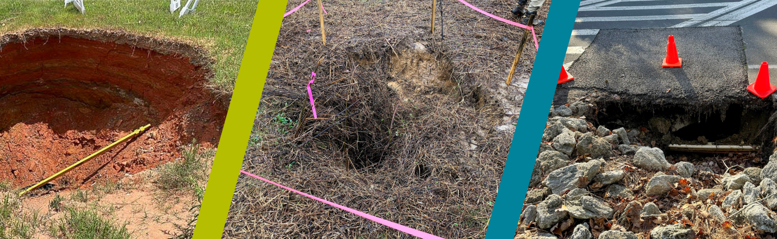
At McMinn County Airport, recurring sinkhole activity occurred in the northern portion of the property. S&ME leveraged geophysical surveys, paired with targeted drilling to investigate the area. By using ground penetrating radar (GPR), electrical resistivity tomography (ERT), and spontaneous potential (SP) geophysical testing, S&ME was able to narrow the exploration area. We performed geotechnical boring with rock coring to extracted borings, provide the geotechnical data to map the site’s most significant karst-related hazards.
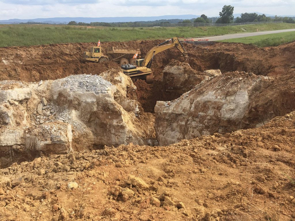 McMinn Airport Sinkhole Investigation
Jason explains, “Karst terrain is common in several states across our footprint including Florida, Kentucky, and Tennessee. Geophysical services help us see beyond surface conditions so we can better target exploration and define sinkhole risk.”
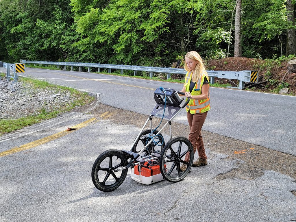
Geophysics testing with ground penetrating radar
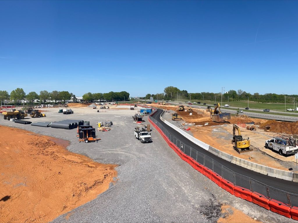
At McGhee Tyson International Airport, S&ME supported construction of a seven-story parking garage by performing geotechnical drilling through highly variable karst terrain. Because karst geology can create abrupt changes in bedrock elevation and hidden subsurface voids, the team used targeted drilling and rock coring to better define conditions across the site. Through subsurface exploration, geologic hazards were identified that directly influenced drilled shaft depths, coring requirements, and foundation design.
Causes of Landslides in Construction
Weak soils, erosion, poor drainage, or even flooding all contribute to the development of landslides. Landslide risk assessment allows clients to identify potentially unstable areas before they threaten construction. Engineers and geologists analyze soil, rock or debris with the goal of:
- Evaluating slope behavior in the context of the geology and groundwater depths
- Identifying where movement could affect infrastructure
- Supporting mitigation design through barriers, retaining systems, and slope regrading
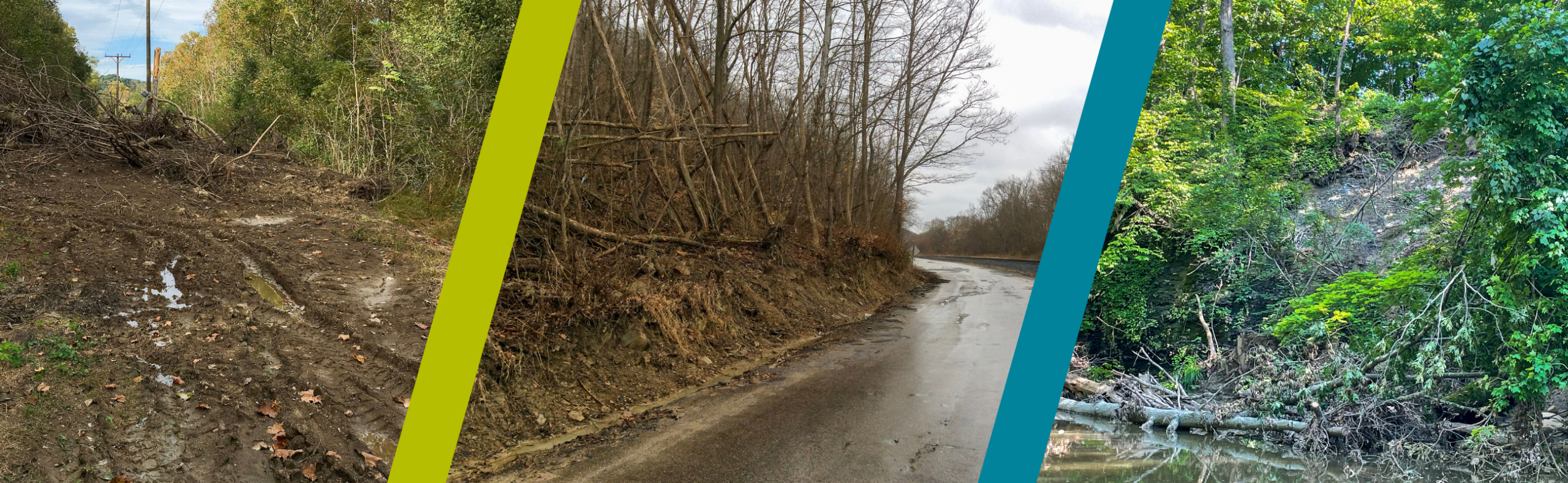
Landslides near energy infrastructure, roadways, and waterways
When an active landslide developed along State Route 772 in Ross County, Ohio, S&ME documented the slope movement and generated recommendations that guided slope stabilization design. S&ME’s investigation included performing 13 borings and collection of topographic survey data. To develop a solution, our engineers prepared a monitoring plan including installation of inclinometers and groundwater monitoring wells. A drilled shaft retaining wall was ultimately designed to stabilize the area.
“Roadway landslides damage transportation infrastructure and disrupt public access, which is why early mitigation planning matters. Geotechnical drilling plays a key role by helping engineers characterize subsurface conditions, finding the source of instability,” says Jason.
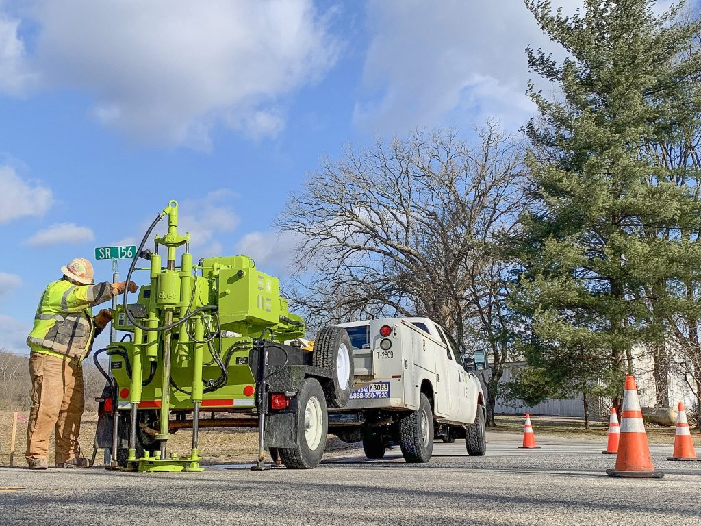
Geotechnical drilling on roadway
How Expansive Soils Affect Foundations
Expansive soils are typically fine-grained clay soils. Based on their minerology, they are subject to shrinkage and swelling behavior. Found in all 50 U.S. states in areas with severe wet and drying cycles, these soils have the potential to shrink and swell under changing moisture conditions and lose strength when wet. Foundations, slabs, and pavement systems supported on expansive soils can be exposed to repeated soil movements that can lead structural distress. This drives up maintenance costs, shortens service life, and complicates long-term performance of structures and pavements.
Other materials such as expansive shale bedrock can also lead to significant movement and structural distress.
Geotechnical engineering services:
- Identify soils prone to shrink-swell movement through soil testing and local experience
- Provide engineering solutions to reduce the effects of expansive soils
- Optimize foundation and drainage design
- Reduce long-term maintenance risk
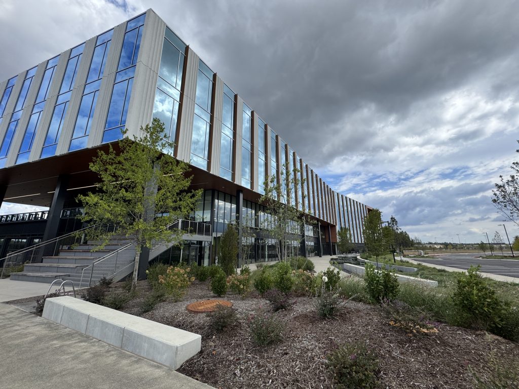
At Spark Life Sciences, a 109-acre advanced life science campus with cutting-edge lab and bio-manufacturing space, S&ME encountered highly plastic near-surface clays and silts common to the Triassic Basin geology. To reduce shrink-swell risk, our engineers recommended excluding these soils from critical near-foundation fill zones, cement-treating the upper subgrade soils, and bearing higher-load foundations on competent rock.
Jason shares, “When moisture increases, expansive soils weaken, which is why foundation recommendations often focus on both stabilizing upper subgrades and limiting those materials near construction.”
Assessing Slope Stability with Geotechnical Engineering
Slope performance is affected by grading and subsurface conditions, influencing how water moves through a site and the stability of the slope. Flooding, runoff, and inadequate drainage can all reduce soil strength. Subsurface exploration provides data on soil and rock materials within the slope area, strength of the slope materials, and water levels. Slope stability analysis evaluates these factors to identify acceptable slope inclinations, requirements for reinforcing slopes (such as geogrid reinforcement, soil nails, tie backs, piles, drilled shafts, or other methods). Through geotechnical engineering services:
- Evaluate slope performance for slope inclinations, changing water levels, seepage, and storm loading conditions
- Address drainage, erosion, and reinforcement needs
- Support safer grading and embankment design
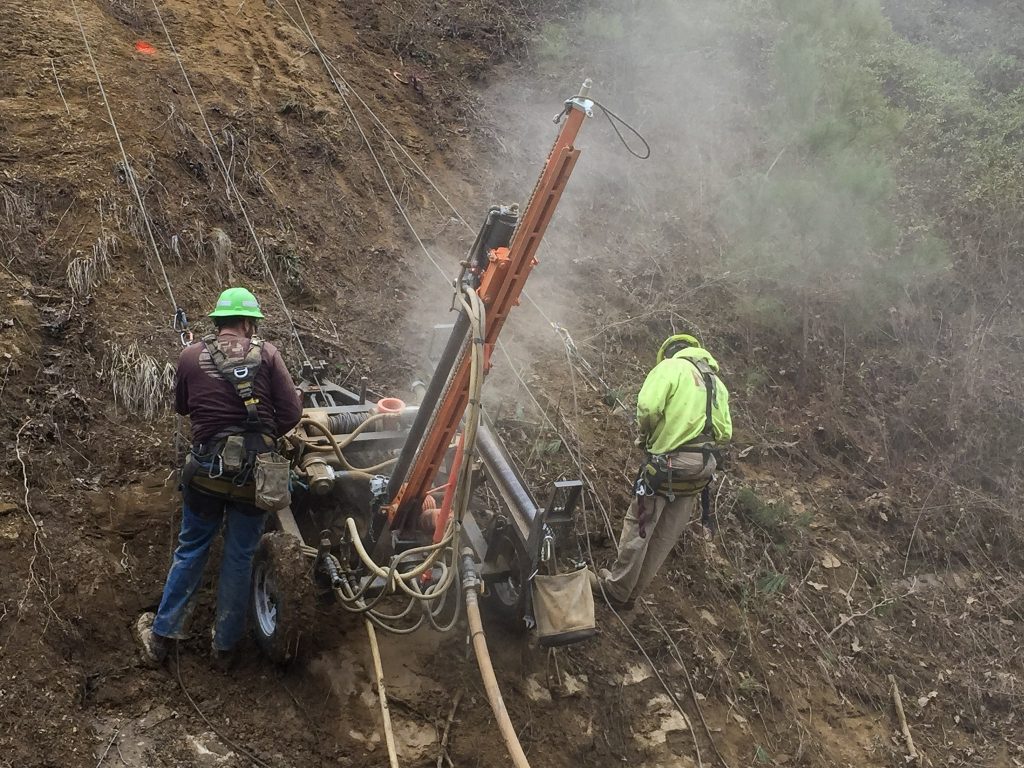
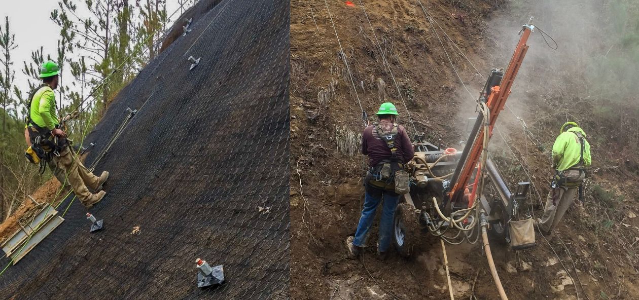
Slope stabilization for rockfall prevention
At a 344-acre public park in Gaston County, slope performance was a central design consideration for a new dam embankment. A High Hazard Dam required detailed evaluation to meet North Carolina Dam Safety requirements. S&ME performed geotechnical drilling including soil borings and geotechnical laboratory testing to develop subsurface profiles and estimate dam foundation and material properties. Our team conducted seepage and slope stability analyses to assess performance under both normal and extreme storm conditions. This approach resulted in a resilient dam embankment designed to perform where critical infrastructure is at risk downstream.
“Geotechnical engineering helps protect downslope infrastructure through resilient design for embankments, dams, and other earth-supported systems,” says Jason.
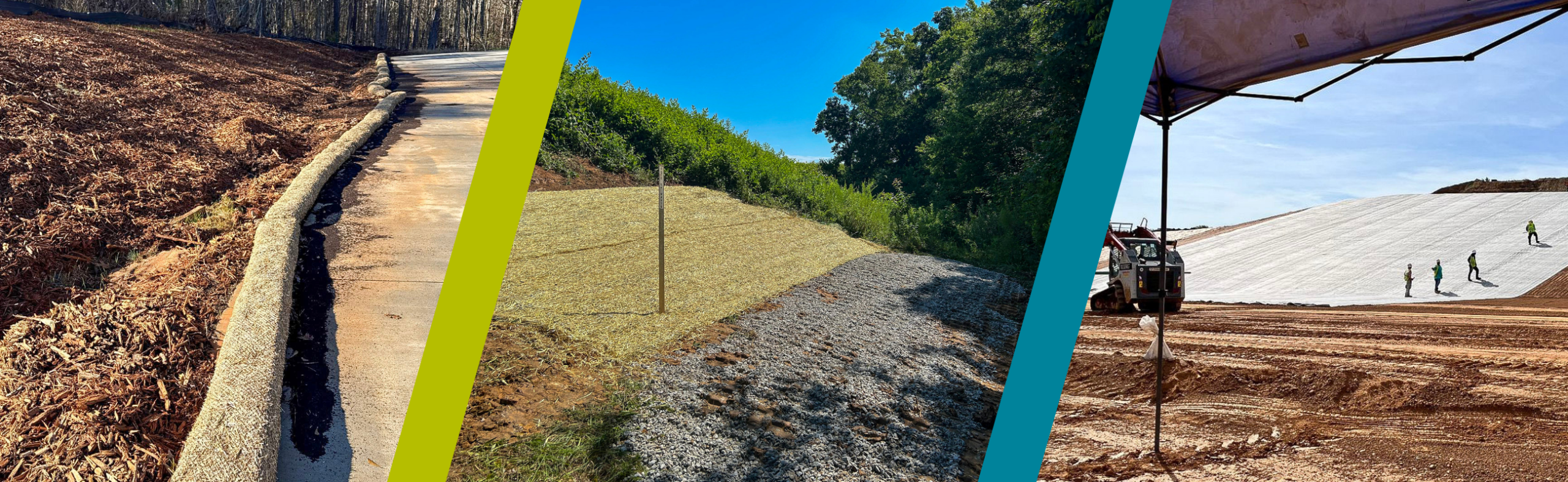 Design methods of stabilizing slopes
Earthquake and Seismic Hazard Assessment
Seismic risk should be considered in construction planning, even outside major earthquake zones. Activity occurs across the Southeast and Midwest. Structural design for these hazards is especially important in coastal South Carolina and near the New Madrid Seismic Zone.
Seismic Activity in Low County
Sandy soils, soft clay, and highly variable deposits all can amplify movement. A liquefaction hazard assessment evaluates whether site soils could lose strength and behave more like a fluid during an earthquake that can lead to significant ground subsidence, disruption of utilities, and damage to structures and pavements.
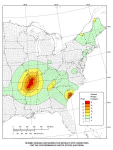
Earthquake hazard map. Photo credits FEMA.
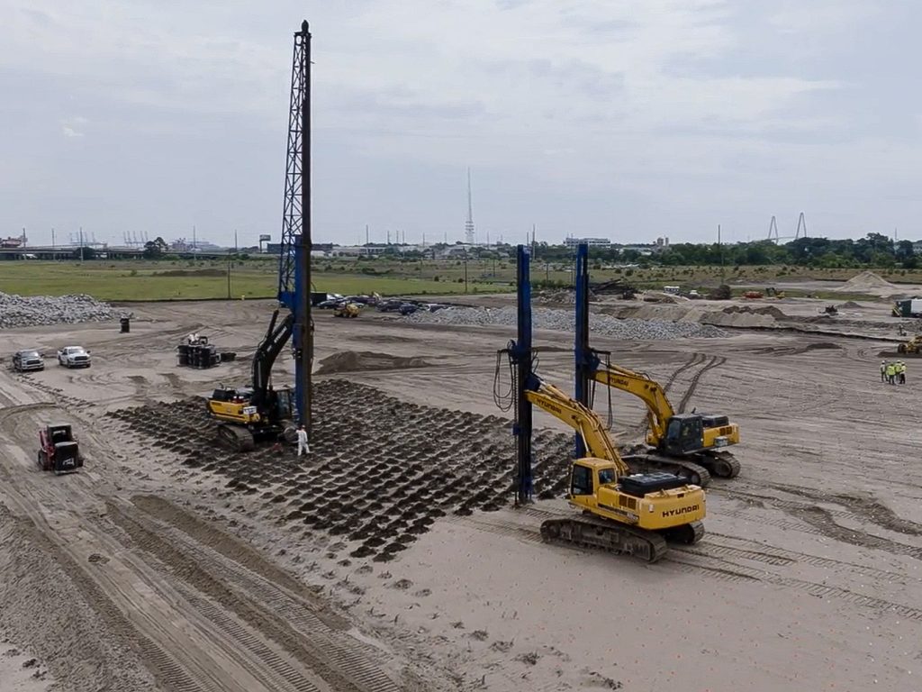
Soil densification by vibroflotation to reduce liquefaction risks
To estimate infrastructure performance throughout seismic activity, geotechnical engineers:
- Perform subsurface site characterization to define the classification and strength of the soils, layering, water levels, and site response behavior
- Conduct geotechnical drilling including soil test borings with Standard Penetration Tests (SPT) testing or Cone Penetration Test (CPT) soundings to estimate soil strength and surface or downhole shear wave velocity (Vs) measurements
- Evaluate how subsurface conditions influence earthquake ground behavior
- Identify liquefaction hazards and estimate seismic demand
- Test Shear wave velocity to estimate the structural Seismic Site Class and soil stiffness during an earthquake
- Perform a Site-Specific Seismic Hazard Analysis (SSSHA) to estimate earthquake ground motions for a particular site
- Recommend resilient design and targeted ground improvement methods
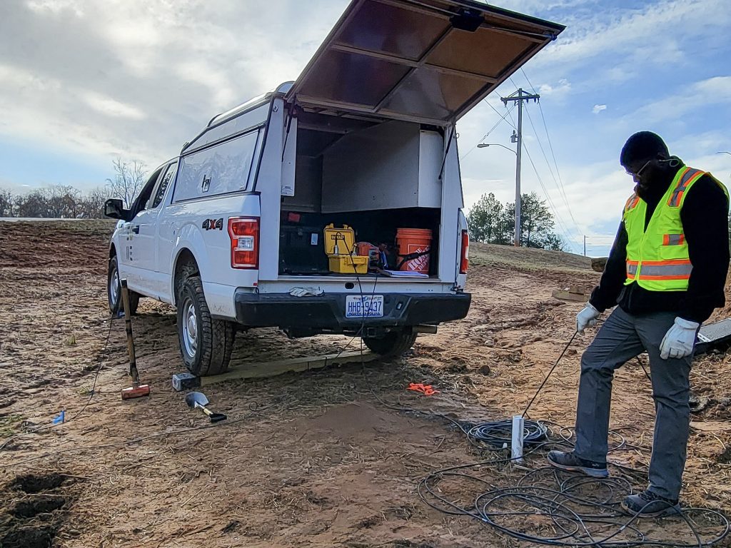
Borehole seismic testing to measure how seismic waves travel through soil and rock
For the new Port Access Road connecting I-26 to the Hugh Leatherman Container Terminal, S&ME evaluated a site with high seismic hazard across Charleston’s historic industrial neck area. Our team analyzed variable ground conditions including liquefiable sand strata and uncontrolled fill deposits. Ground improvement measures such as earthquake drains, surcharging, and column-supported embankments helped support approach embankments, decrease liquefaction potential and settlements, and reduce seismic loads on foundations.
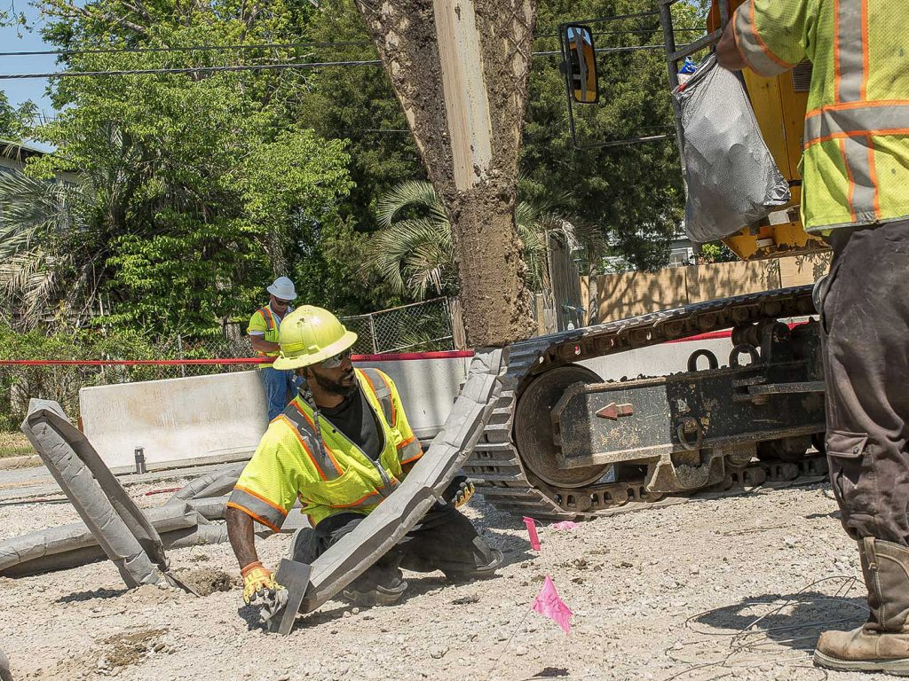
Installation of earthquake drains
Jason explains, “Earthquake engineering guides foundation design where seismic risk affects performance.”
Subsurface Hazard Identification Methods
The strongest hazard assessments leverage several geotechnical engineering services. By combining aerial imagery review, geophysical testing, and geotechnical drilling, project teams can recommend design strategies with reliable geotechnical data.
- Aerial imagery review helps identify patterns and surface indicators
- Geophysical testing refines areas for subsurface investigation
- Geotechnical drilling confirms subsurface conditions and supports design decisions
Geotechnical Design Solutions for Hazards
The true value of a hazard assessment is when data is translated into design solutions. Geologic hazard mitigation strategies help teams respond to risk through:
- Ground improvement
- Drainage controls
- Specialized foundation systems
- Retaining and reinforcement structures
- Slope stabilization and regrading measures
S&ME brings a site-driven approach to hazard mitigation, aligning design strategies with real-world conditions and performance expectations of our clients.