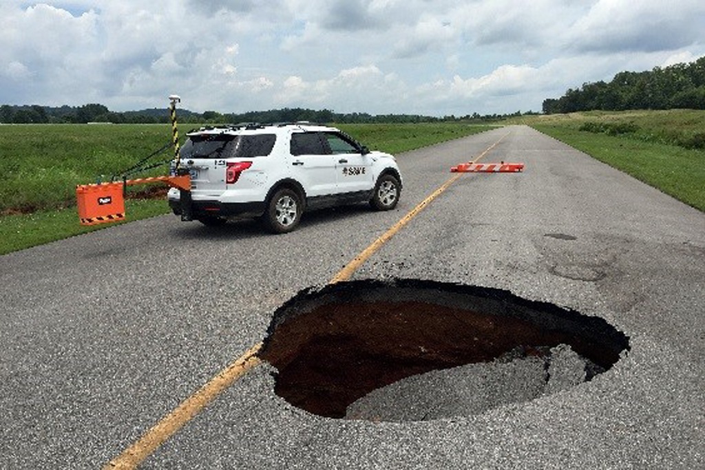
Sinkholes have been forming for several years in the northern portion of the McMinn County Airport. Typically, the county undertook ad hoc repairs at each occurrence. However, the rate of occurrences had significantly increased. Worse, new sinkholes were forming adjacent to previously repaired sinkholes. As such, the county needed a consultant to help identify possible trends and/or anomalous features that may explain the prevalence of sinkholes.
S&ME utilized a variety of geophysical methods including ground penetrating radar (GPR), electrical resistivity tomography (ERT), and spontaneous potential (SP). The team identified several anomalous subsurface features as well as the approximate locations of the most noteworthy features.
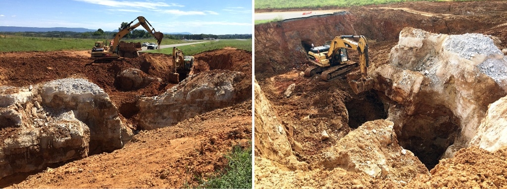
Guided by these results, S&ME implemented a cost-effective boring program. This allowed us to more accurately identify and confirm the extent of the underlying karst conditions at the site. Tests indicated significant karst activity. Specifically, tests revealed epikarst soils (i.e. very soft soil and weathered rock) associated with sinkhole development and/or conditions indicative of solution activity within the bedrock.
Some karst activity was likely the result of construction activities and the introduction of water into the hydrologic system from the unlined drainage ditches paralleling the taxiway. Nevertheless, complete elimination of future sinkhole activity is unlikely considering the extent and depth of the bedrock. However, repairs to the existing sinkholes are currently underway and measures to reduce the frequency of sinkhole formation near the runway and taxiway are planned by controlling surface water runoff and preventing its collection in ditches adjacent to the airport structures.
Highlights
- Cost effective means to assist in developing a geotechnical boring program
- Significant karst activity