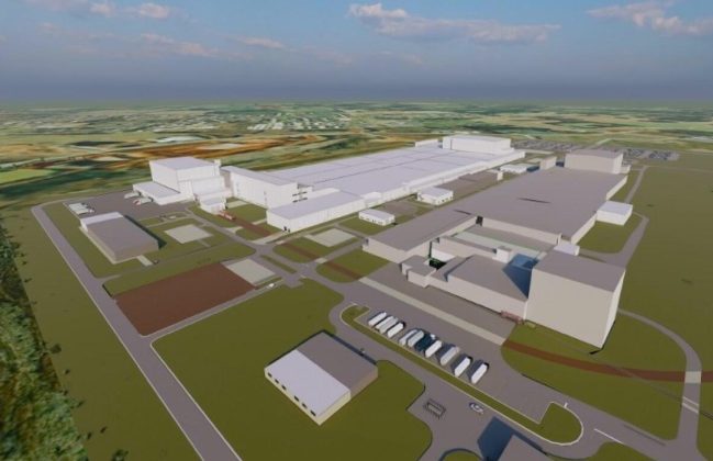
Sewer System Evaluation Survey and GIS Mapping for the Town of Lynchburg

Custom Sanitary Sewer Web Mapping Application for Lynchburg Utility PersonnelHigh Accuracy GNSS Data Collection in Lynchburg
Custom Sanitary Sewer Web Mapping Application for Lynchburg Utility Personnel
High Accuracy GNSS Data Collection in Lynchburg

In 2019, the Town of Lynchburg, Tennessee, contracted S&ME to evaluate and map its sanitary sewer system. S&ME employed a multi-tiered approach to build a comprehensive Geographic Information System (GIS) for Lynchburg’s sewer system. S&ME was able to provide updates to Lynchburg’s sewer system by digitizing paper as-built maps, digitizing sewer easements, and using high accuracy, survey grade Global Navigation Satellite System (GNSS) equipment to map the entire sewer system. S&ME conducted a Sewer System Evaluation Survey (SSES) that included manhole inspections, smoke testing, and closed-circuit television (CCTV) inspections of the entire system. SSES will identify sources of infiltration and inflow (I/I) and collect data to formulate rehabilitation needs throughout the 210 sanitary sewer manholes and 41,762 LF of sanitary sewer gravity mainline. To summarize this data, S&ME generated a powerful online mapping system incorporating all aspects of the project, including the mapped sewer system, SSES datasets, and linked web-based multimedia. Importantly, the Town of Lynchburg can view these maps either in the office or on mobile devices in the field. When new issues arise, these online tools will allow for enhanced real-time decision making. Additionally, these final datasets contain sewer assessment rankings, which will aid the Town of Lynchburg in rehabilitation planning and design of their sanitary sewer system.