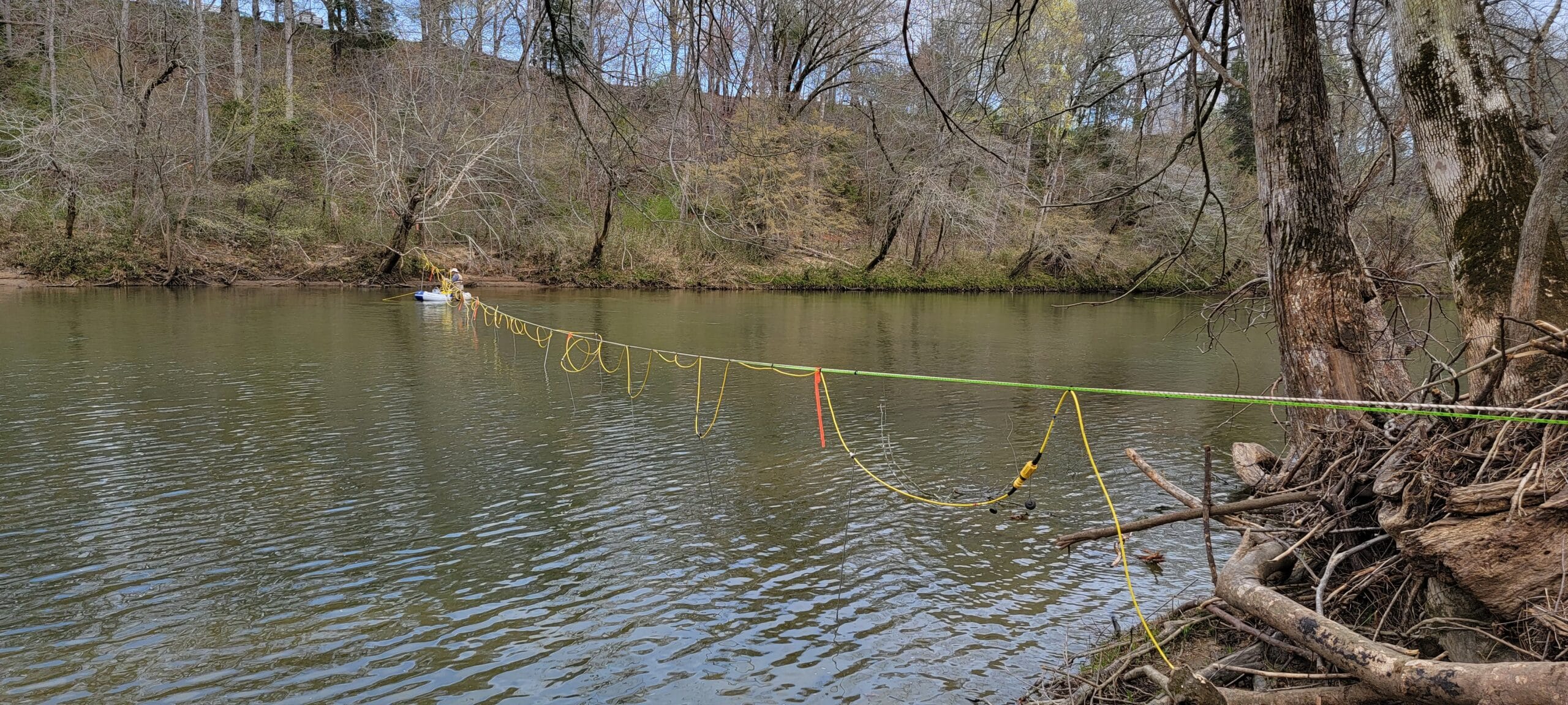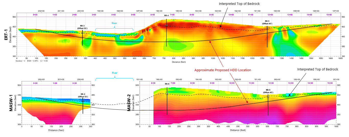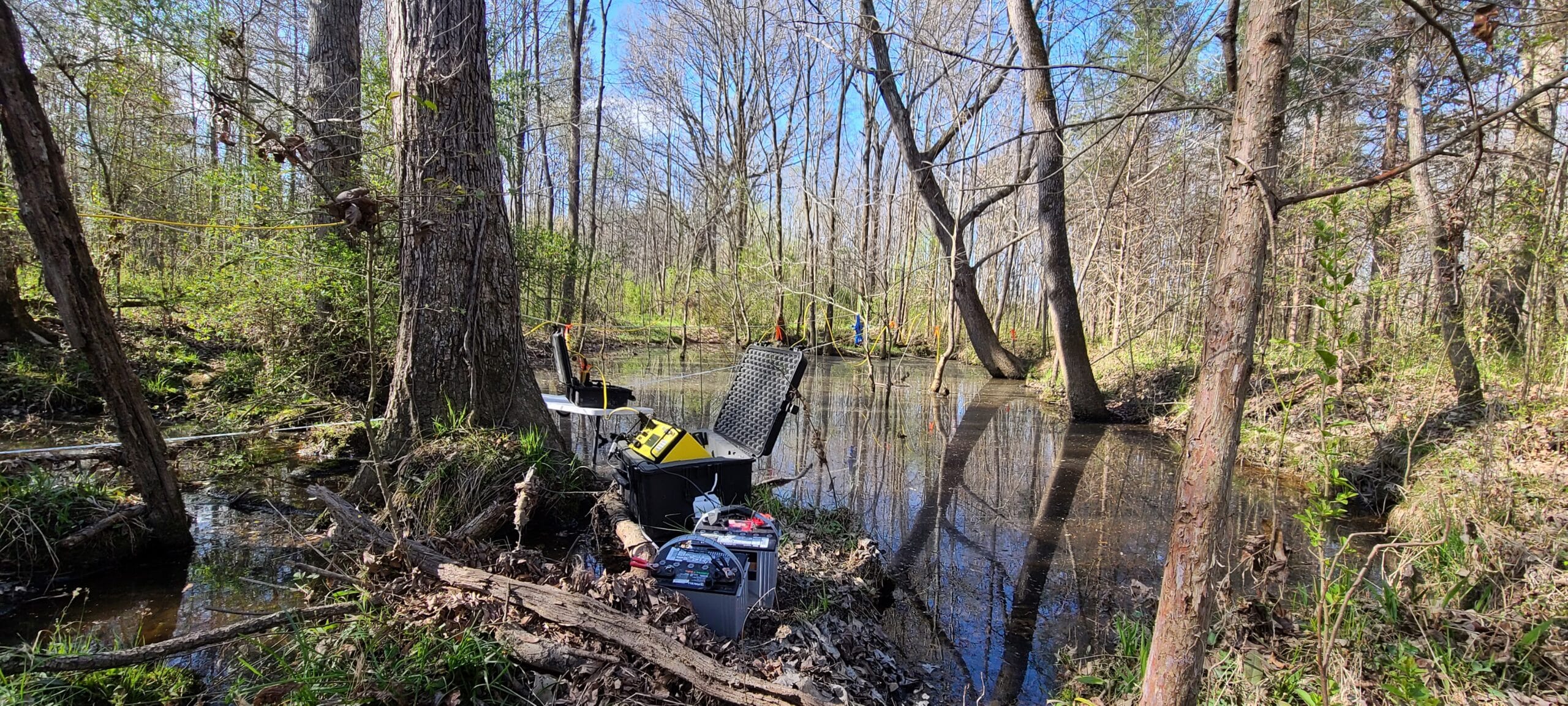
A proposed new gas pipeline requiring horizontal directional drilling (HDD) beneath a significant regional creek and a significant regional river, both in complex metamorphic subsurface conditions in the Piedmont Physiographic Province, southeastern US, had planned maximum depths of about 95 feet below the surface. Geotechnical exploration borings and a geological reconnaissance had previously been completed and showed significant fracturing and regional/local faulting. To assist in locating and defining these subsurface conditions relative to pipeline design and construction considerations, it was requested that S&ME provide Electrical Resistivity Tomography (ERT) and 2D MASW profiles along the planned HDD alignment.
A 2D MASW survey uses variations in frequency of surface waves generated by an active energy source. These waves are processed to obtain shear wave velocities that provide an indication of material density in the subsurface, and which can then be developed into a 2D cross-section. The ERT method uses a known amount of direct current and measures the response to identify variations of subsurface material properties. This project provided an additional challenge where it was imperative to cross between 30 feet to over 150 feet of flowing river with ERT where the 2D MASW was unable to be conducted.