October 20, 2023
Drones and Disaster Recovery
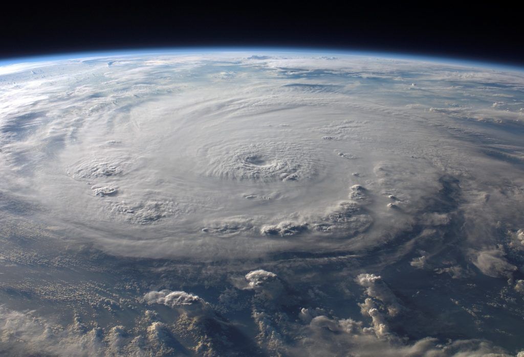
Hurricane season occurs June through November. Warm ocean water and moist, humid air are the ingredients needed to form these powerful storms. As they make landfall, hurricanes often cause substantial, life-threatening damage to structures and infrastructure. Timely evaluation and repair after hurricane damage are essential for community resilience.
The use of unmanned aircraft systems (UAS), commonly referred to as drones, can provide hurricane response teams with the ability to quickly evaluate changes in a roadway infrastructure system or the natural environment from an aerial view. This tool can show response teams how the environment may have changed from a hurricane and inform infrastructure rebuilding needs. Additionally, drones provide photo documentation of inaccessible roadways and bridges and live-feed video to a centralized command center for operations staff to notify emergency response teams of damages in real-time.
What Are the Benefits of Using Drone Technology for Disaster Recovery Efforts?
- Bring clarity to every mission.
Drones can collect valuable data for locations that are otherwise inaccessible from the ground.
- Allow first responders to be prepared for a mission.
The data provided by drones allows first responders a full picture of what safety hazards they may encounter on a mission and/or what to communicate to the public.
- Image transmission capabilities allow live streaming of video feedback to the command station.
Disaster recovery is often time-sensitive. Live streaming capabilities allow for critical data delivery, with little to no wait times.
- Thermal Imaging with FAA Night Waiver assists first responders in search and rescue operations.
Search and rescue efforts do not stop when the sun goes down. The ability to operate at night eliminates lengthy wait times.
- Tethered drone platforms provide aerial view and inspection of high-value and/or high-risk sites like dams, bridges, interstates, and power plants.
This tool provides a view of the entire picture of a site, including the infrastructure to be addressed.
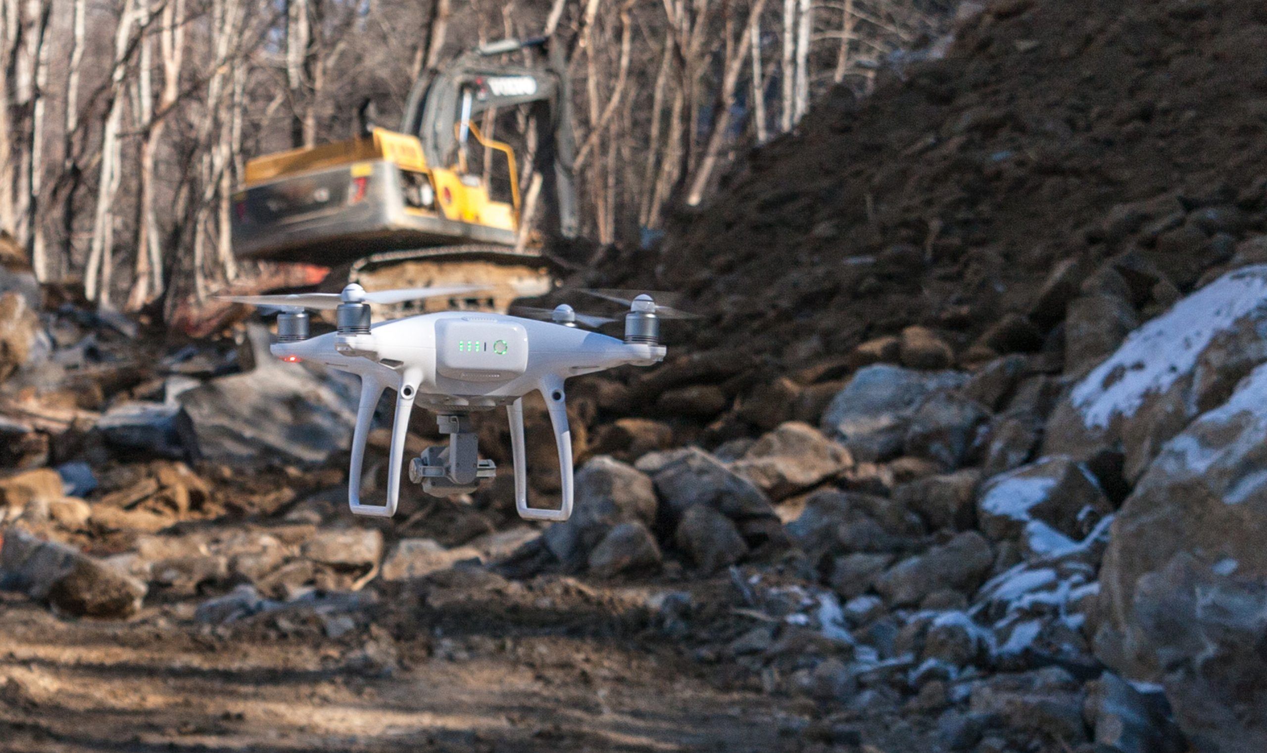
S&ME’s Drone Team
Within our transportation market, we work closely with the North Carolina Department of Transportation (NCDOT) when disaster strikes. Our teams are ready to deploy at a moment’s notice and receive missions from a “Central Command” to position us to inaccessible areas to document the severity of damage in real-time. Once S&ME deploys to a site, our teams set up wireless live-feeds for “Central Command” personnel to view real-time conditions. This data is invaluable to local law enforcement and new organizations to disseminate information to the public. With this, safety is improved, and lives can be potentially saved.

Our drone fleet includes six DJI Phantom 4 Pros, one DJI Mavic 2, and one DJI Matrice M210 RTK. The DJI M210 can carry an infrared camera for more advanced search and rescue operations. S&ME also possess an FAA Certificate of Waiver, which allows us to perform nighttime UAV operations in addition.
S&ME Case Study
Hurricane Florence Relief Efforts
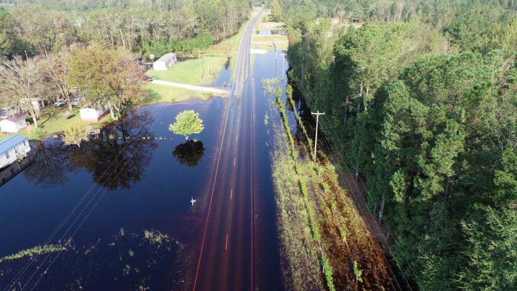
S&ME supported various entities during the recovery of Hurricane Florence. After the storm dropped roughly 8 trillion gallons of water on North Carolina, environmental services performed asbestos testing, mold and moisture investigations, and lead paint inspections.
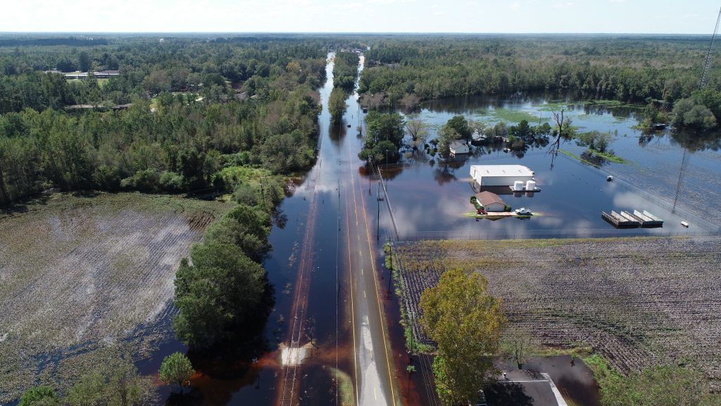
After Florence, road damages alone were upwards of $250M, and technology played a large role in disaster recovery. For the first time in North Carolina, through an Aviation Unmanned Vehicle Contract within our Transportation Business Unit, NCDOT employed S&ME’s assistance to use drones for hurricane disaster recovery efforts. This footage helped our staff monitor floodwaters to estimate changes in road conditions and allowed for accurate communication of life-saving information to keep people off roads and send emergency vehicles and response agencies as needed.